Hiking field Notes for Alaska and British Columbia, updated Summer 2004.
* Shearwater, B.C.:
Go into the boatyard near the marina,
then move west and go up the hill. A trail, not easy to see from the
boatyard, begins to make itself visible as you climb up. You will
come to a gravel road, walk south. Croil Lake appears in the right of
the road, along with a sign leading to the Eddie Lake trail. Visit
Croil Lake, then notice that the trail continues.
The Eddie Lake trail is fairly long and
can be very muddy at some times of year, wear appropriate shoes. It
is quite enjoyable and there is not much climbing involved.
* Ketchikan, AK:
Rainbird. Go to roughly 55d 21.34m n,
131d 40.67m w on a college campus. Go north behind a maintenance
shed, climb the hill on a reasonably well-marked trail, you will
encounter a large flat trail that leads east (rainbird trail). There
are some trails that branch off from this trail, that go up to a
lookout and elsewhere (the latter not walked yet).
Carlanna Lake. Go to roughly 55d 21.34m
n, 131d 41.61m w (Canyon road), this becomes an uphill gravel road
leading to the lake. Supposedly, if you go to the east side of the
lake and go uphill, you encounter a trail that ascends Minerva
mountain, east of the lake (the latter not located or walked yet).
* Wrangell, AK:
Walk from the marina to the beach with
the petroglyphs (NW of marina a couple of miles – walk near the
beach). On the way back, move east into the woods and climb the ridge
that lies directly north of the main part of town. The north face is
rugged without much in the way of trails, but it affords a nice
challenge, and a trail can be acquired from the top back into town on
the south side. Watch out for the town dump located north of the
ridge, it is an old-fashioned open dump with plenty of bears.
* Petersburg, AK:
Go to a gravel parking lot at 56d
48.19m n, 132d 55.72m w, near the east end of the airport runway,
look for a sign for Raven's Roost Trail. Walk west along a gravel
road, take the first left, walk south on another gravel road, watch
for a trail sign on the right near a small building. Walk along a
gravel path that becomes a wooden walkway through muskeg, now you are
on the trail.
This is a fairly long trail, not
terribly difficult, developed in places along its entire length
(wooden walkways, staircases, etc.). It gradually rises about 1700
feet to a large muskeg meadow with a view of town, then it descends
to the southwest of town alongside Wrangell Narrows. Be aware that
the trail doesn't end on top, it continues, so you have to decide if
you are going to return to your starting point or descend by a
different route than you ascended.
A worthwhile hike, very pretty, and a
walking staff is a good idea.
* Juneau/Perseverance trail:
Go to roughly 58d 18.38m n, 134d 25.1m
w (Evergreen road), join Gold creek flume, a walkway on top of a
water flume that bears NE. Join perseverance Trail at the end of the
flume. This trail ascends into some pretty canyon areas, and Mt.
Juneau Trail branches off to the left (west). Haven't walked Mt.
Juneau Trail yet, but Perseverance is very nice.
* Juneau/Mount Roberts Trail
From the marina, travel to the top of
sixth street in Juneau, notice the staircase — that is the
trailhead. The old trail ascends directly from town, rather rough and
wet in this part, and ascends to the top of the tram. Of course, no
one would consider riding the tram instead. :)
Then the trail ascends a rocky ridge
and comes out on a hilltop, where it forks. The right-hand trail goes
to Mount Gastineau and then Mount Roberts, both very steep knife-edge
ridges. The left-hand trail leads to Gold Ridge, a nicer destination
for those not in the mood for a life-threatening experience. Gold
Ridge affords nice views of town and the surrounding countryside.
Goal: Climb Gastineau Peak on a day
with much less wind than you experienced this time.
* Juneau/Auke Bay (just north of
Juneau)/Skating Cabin Trail
Travel from the marina along Mendenhall
loop road, then to the west side of Mendenhall Lake. Note the
historical cabin, marked “skating cabin.” The trail just north of
the cabin is actually two trails, unmarked of course. One (the main
trail) moves along the west side of Mendenhall Lake and then ascends
into a wilderness to the northwest, becoming more and more
ridiculously steep as it does. Once you are looking down on
Mendenhall Glacier, you know you are on this trail.
To visit the glacier, on the other
hand, watch for a shelter off the right-hand side of the trail well
before you even approach the glacier. This shelter marks a second
trail, one that descends to the shore of the lake, then ascends
across a rocky ridge (with some very steep hand-and-foot rock
climbing for a spell), then approaches the west side of Mendenhall
Glacier. Pay particular attention to your return route as you travel
on this trail, it is poorly marked and difficult to retrace until you
have walked it several times (most Juneau locals have never seen it,
and cannot locate it). Very pretty ice caves and overhangs, somewhat
dangerous as well. A worthwhile hike.
* Cordova, AK:
This town has an excellent hiking trail
(in fact, several). Go into town and locate (or ask directions to)
the ski area. It's at the top of “ski hill road.” As you come to
the top of the gravel road, near the base of the ski lift, a trail
appears at the right, about 50 yards west of the ski lift line. Climb
this trail. At the top of this trail are (1) the top of the ski lift,
and (2) a relay station/antenna farm.
But this is just the beginning! To the
north of the relay station is more trail, well-maintained and very
interesting, moving at first along a saddle, through muskeg meadows
and small ponds and lakes, very pretty country, leading up to a much
higher peak that overlooks the town from the NE. Both the relay
station and the higher peak are visible from the marina. Just look
toward the NE, they are both in the same quadrant.
Another trail begins south of town at
60d 32.234m N, 145d 45.685m W, with a gated entrance to a gravel road
with all sorts of warnings about “authorized personnel only,”
apparently meant to discourage off-road vehicles. Hike up to a
storage tank, take a trail to the left, pretty soon you will come up
to a reservoir and a very pretty alpine meadow area. There are some
mountains around the meadow, easy access, that should be nice hiking
later in the summer (first hike was in May 2004, snowy and wet).
* PWS/Whittier
There are two trails here (more,
actually). One, Horsetail Falls Trail, rises behind town, the other
runs east to Shotgun Cove. I have only walked the first.
It is not easy to describe how to get
to the Horsetail Falls Trail by way of city-style directions, just
ask someone or go to 60d 46.346m n, 148d 40.627m w, near the
trailhead. The first part of the trail is well-developed with wooden
walkways, and ends on a nice hilltop with a view. But as is so often
true in Alaska, there is much more of a hike beyond the end of the
trail. The terrain is increasingly alpine beyond the end of the
trail, eventually becoming a glacier. Very scenic and fun.
The second trail, to Shotgun Cove,
begins as a gravel road in town and then becomes a footpath
(reportedely, have not yet walked it). It sounds very promising.
* PWS/Galena Bay near Valdez
This trail runs between the lagoon at
the east edge of Galena Bay and Silver Lake. This is a difficult
trail, seven miles long, very challenging terrain, and at present
(5/2003) it doesn't actually get to the lake.
Anchor at the east end of Galena Bay at
60d 56.229m n, 146d 36.065m w, at the entrance to the lagoon. Paddle
into the lagoon (at low tide this requires some portage). Leave the
boat at 60d 56.459m n, 146d 33.875m w and walk north, watching for
orange plastic trail blazes on the trees (over time the bears tear
down, then chew up, many of the plastic blazes). Join the trail when
it is encountered. The trail at this stage follows the south side of
Duck Creek, through some very rough terrain with plenty of bears (in
late May 2003 there was fresh bear sign everywhere).
Near the lake there is a rope across
the creek, too high to pass in the spring, that moves the trail from
the south to the north side of the creek. This ford was not followed
due to high water. I made my way up a ridge on the south side to a
view of the lake and surrounding mountains, but it appears it would
be very difficult to approach the lake from the south side.
This is a very difficult trail, and
because this is a brown bear area one would be wise to carry bear
defenses and be watchful. As mentioned above, there were fresh bear
sign everywhere in the area. I met a bear hunter on the trail, and he
said several bears had been killed in the immediate past. The trail
is pretty in places, and is a rewarding experience in spite of
everything.
* PWS/Naked Island
5-19-2004. Naked Island, more or less
in the middle of PWS, is sufficiently remote from the mainland that
there appears to be few/no bears, also the hiking is relatively easy
– a reasonable percentage of muskeg meadows, though not as open as
some of the hikes on Perry Island. A nice goal for the summer would
be to climb the peak on the east side of the island, 1235' high,
located at 60d 38.794' N, 147d, 20.712' W, where a relay station is
located. There are no really established trails, but the terrain is
sufficiently open that making one's own trail is easy. Avoid Bass
Harbor in any south semicircle weather – also it gets constant
ocean swell, even with no wind.
* PWS/Perry Island
Anchor at about 60d 43.3m N, 147d 56.6m
W, in a cove on the west side of the east bay of the island. This
anchorage is a little rough in west wind because of low terrain to
the west. The bearings for the following two hikes are in reference
to this anchorage.
Hike #1: An east-west ridge south of
the anchorage, much more difficult to walk than it appears from the
anchorage. Hike west at low elevation nearly across the width of the
island in mostly muskeg meadows, then turn south when possible to
ascend the east-west ridge at its lowest point. Then hike east to
climb the ridge. Very irregular, difficult terrain on top, nice
views. Most of the hike is in meadows with a small amount of brush
near the shore and in the ascent. Be sure to follow your outbound
course exactly on the return, there are many vertical rock faces in
this area, easily seen from below but not at all from above.
Hike #2: For the most part, an easy,
gradual ascent in meadows to the NW of the anchorage, rising
gradually to several peaks with nice views, total climb about 800
feet. This is one of the least brushy hikes in the entire area, and
with many ponds and nice meadows would be a great introduction to PWS
hiking for a newcomer. Near the top, things become more complicated
and one would be wise to mark one's route to avoid difficulties on
the descent.
* PWS/Cascade Bay, in Eaglek Bay East
of Whittier
Cascade bay has a nice waterfall. The
entrance has a glacial moraine that is very shallow (as in ten feet
at low tides), in fact I think this bay was probably a lagoon before
the 1964 earthquake. Enter very carefully.
There is a lake that feeds the
waterfall, and there is a trail to the lake. Looking at the chart one
might think that simply crossing the ridge will lead to the lake, and
although this is true, it is a much greater altitude gain than is
necessary. Instead, go to the beach that is SW of the falls, beach
the dinghy, and walk north, staying near shore. Enter a canyon with
some muskeg meadows, and a trail will appear that goes up to the
falls and the lake.
BUT! To see more lake, the north side
of the lake looks better (not as steep, affording more chances to
walk a good distance along the shore). Looking from the south side of
the lake, it became obvious that the north side would have been a
better goal. Try to find a trail on the east side of the falls next
time. The distances are not great, but the terrain can be
challenging.
Anchor in front of a bight across from
the falls, there is an uncharted shallow spot well offshore that must
be sought out, and with reasonable holding (60d 54.84m n 147d 48.27m
w). There are what appear to be lion's mane jellyfish in this bay, so
no swimming or falling out of boats.
* PWS/Bainbridge Island/No-Name Bay
There is an unnamed bay on the
southeast of Bainbridge Passage, anchor at about 60d 7.45m N, 148d
6.71m W, this is a sheltered spot in 5 fathoms, almost in the mouth
of a river that leads to a lake. Paddle in along the river until you
get to a suitable place to hike, with muskeg meadows in view on the
south side of the river, then beach the dinghy. Hike generally SSW to
get to the lake or to ascend to the higher terrain. There is a nice
peak at about 1500 feet, or, if there is less snow than I found (late
June), one can ascend higher by crossing an alpine meadow to another,
higher peak. There are black bears in this neighborhood, but they
don't seem particularly aggressive, at least in June.
There is another pleasant hike east of
this anchorage, on the ridge that separates Bainbridge Passage and
Prince of Wales Passage to the east. The ridge ascends about 700 feet
and the top of the ridge is an easy walk, mostly muskeg, but
ascending to the ridge is sometimes difficult.
Yet another hike for the future is to
beach the dinghy southeast of the boat and hike generally SSE to
ascend by a different route, one with less brush. This route was
first seen once I had climbed the peak to the SW, and is not clearly
visible from the anchorage. The route has more and larger muskeg
meadows than the other routes and reasonable terrain for climbing.
* PWS/Cochrane Bay/Three Fingers Trail
A very nice trail, emanating from a
very nice anchorage (the easternmost of three connected bays at Three
Fingers Cove). The trail goes to a publicly maintained wilderness
cabin at Shrode Lake. It is very pretty, not difficult, one river
needs to be forded in a wide, shallow passage (knee-deep). Be sure to
explore the area at the end of this trail next time – visit Lake
Jack and/or Long Bay, both destinations accessible from the Shrode
Lake cabin.
* PWS/Granite Bay. No name mountain
south of inside anchorage, whose peak is located at 52d 16m n, 148d
3.51m w.
Very nice view of western PWS, easy to
walk on top, mostly granite, little vegetation. A rewarding climb.
Route 1 (7/8/2003): For my first climb
of this mountain (no name, 1700 feet) I approached from the north
(the main Granite Bay anchorage), then ascended with difficulty
through muskeg and brushy areas to get above the tree line, then
walked along a ridge that ascends to the peak from the NW. This
specific approach was terrible for a bunch of reasons, mostly the
requirement to bushwhack long stretches at the lower elevations, so
this approach is not recommended for the future. Next time, consider
an approach from the SW, where there are approaches across some large
smooth slabs of granite beginning at a low elevation, and little
obstructing brush (the rock might be dicey on a wet day). Overall a
great opportunity to ascend above the typical Alaska brushy terrain
on a route mostly of rock (if the right approach is chosen).
Route 2 (7/1/2004): I decided my first
route was unnecessarily difficult, so I anchored west of the mountain
in a small, sheltered anchorage at about 60d 52.94m N, 148d 5.60m W,
where a buoy is marked on the chart (but is not present any more).
The holding is not very good in this location, but with patience one
can anchor securely.
This second route was easier, more
muskeg meadows along the way and less steep climbing, but there is a
problem – there is a climbable notch along the way in an otherwise
very steep, rocky face that can be seen from below but cannot be seen
from above. Be SURE to flag this notch on the way up, and be SURE to
follow the exact same route on the way down. Otherwise, by descending
along a seemingly natural route, one gradually approaches a
semicircular sheer bluff.
Route 3 (7/6/2004): This is a route
that is in all ways better than those described above, consisting of
a gradual rocky ramp, relatively clear of brush, that ascends from
the SW of the mountain. Begin at the small anchorage SW of the
mountain, enter into the little valley that lies SW of the mountain,
circle around a small lake, then make your way to a rocky ramp NE of
the lake that ascends to the ridge leading to the peak. This route
frees one from the insect-infested brush quicker than any route yet
tried, and it is easier than the other approaches. Because of the
presence of many abrupt drop-offs visible only from below, this route
also must be marked during the climb and the inbound route must be
matched during the descent.
* Blue Fox Bay, Afognak Island, AK
To the west of Blue Fox Bay is a
multiple-peak mountain named “Devil's Paw”. There is a trail
leading from Blue Fox Bay west, up to the high country and to any of
the peaks one cares to challenge. Part of the trail is steep and
challenging — a hiking staff or ski pole is almost a must for the
steepest parts. Enter Blue Fox Bay, go to the south end, find the
shelter cabin (not private property) at the west side of the south
end. The trail begins about 100 meters north of the cabin, at a tree
that extends out on the beach. The trail is not marked but is
relatively easy to follow.
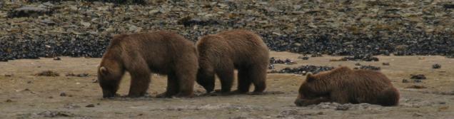
There are bears in this neighborhood.
Some fresh bear scat appeared within two hours between my ascent and
descent, and for all I know it was left by a bear that was stalking
me. And, from the evidence of one scat pile, they're big bears,
Kodiak bears. Didn't actually see any bears, but the evidence left
little to the imagination.
There is a great view from the top of
the north peak of Devil's Paw, but on revisiting this site, it seems
the south peak is much easier to climb and affords terrific views
also.
* An unnamed island in front of the
Geographic Harbor entrance, west of Kodiak Island on the Alaska
Peninsula.
This island lies east of Takli, the
main island lying in front of the entrance to Geographic Harbor.
Anchor on the north side near a sandy beach – best on days with SW
wind. Allow two or more hours for a full exploration. There is bear
sign in various places, so this is not a bear-free zone as one might
expect. There is an old native camp with obsidian chips that has been
explored by one or more professionals (numbered obsidian pieces on
the ground, a screened protective frame over a site of particular
interest).
Obviously there are any number of
islands to choose from, but this one is not particularly hilly, it is
not sufficiently brushy as to impede hiking, and it's just the right
size for a relatively brief exploration. And it is very pretty. A
nice stopoff in the event that the current is running strong in the
entrance to Geographic Harbor.

 Share This Page